
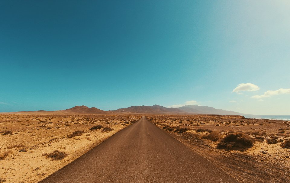
Most of our rides stay inside the cities. This one leaves them behind. The Hanford Reach National Monument, north of Richland across the Columbia, holds the largest stretch of shrub-steppe left in the state, a free-flowing river, and the White Bluffs, a line of pale cliffs that stands 300 to 400 feet above the water. The gravel roads of the Wahluke Slope, on the north side of the monument, are open to bikes and almost empty. It is the most remote riding within an hour of the Tri-Cities, and it asks for real preparation. Here is what we have learned.
Where it is and how to get in
The Wahluke Unit is reached from State Route 24, the road that runs north from the Tri-Cities toward Othello. From Richland the drive is about 40 miles and 50 minutes: north on SR 240 along the Hanford site perimeter, over the Vernita Bridge, then east on SR 24 to a signed gravel road heading south into the monument. The entrance is a cattle guard, a gate and an information board, nothing else. The gravel road drops down the Wahluke Slope for about six miles to the river, where it forks: one branch to the old White Bluffs boat launch and ferry landing, the other along the bench above the river. There is dirt parking at the entrance and at the boat launch, room for a dozen vehicles at each, with no restroom, no water and no cell signal on most carriers. The monument is day use only, from sunrise to sunset, and it is free.
The roads and the overlook
The riding is on a network of maintained and unmaintained gravel roads, some sandy, some washboarded, some hard packed clay that turns to glue in rain. Our standard loop starts at the entrance, descends the main road to the boat launch, rides north along the river bench toward the base of the bluffs, and climbs back to the rim on one of the connecting roads, then returns along the top. It is 22 to 26 miles with about 1,200 feet of climbing, mostly in one long grade of four to seven percent from the river up to the slope. The White Bluffs overlook trail, which follows the top edge of the cliffs north from the boat launch for about two miles to the dunes, is a footpath; we leave the bikes at the trailhead and walk it. The view from the edge takes in the river bending below, the old Hanford reactors across the water, and Rattlesnake Mountain beyond. Stay well back from the lip: the bluffs are soft silt and clay, they calve without warning, and the drop is fatal.
Monument rules that apply to cyclists
The Hanford Reach is a national monument managed as a wildlife refuge, and the rules are stricter than a county park. Bikes are allowed only on roads that are open to vehicles; trails, the bluff edge and the beach are for feet. No camping, no fires, no drones, no collecting: the ground here is full of cultural and historical material and it is protected. Dogs must be leashed. Some units close seasonally to protect nesting birds or during fire danger, and the gates on SR 24 are the only notice you will get, so check the refuge website before you drive out. The south side of the river is the Hanford Site itself; it is closed, patrolled and not a place to wander. Carry identification. Rangers are rare, but the rules are not optional.
Tires, water and the sun
This is the one ride on our list where the equipment list is not negotiable. Tires of 40 mm or wider, with tubeless sealant, because the sand is deep in places and the goatheads on the river bench are the worst we have seen anywhere. A plug kit and two spare tubes. At least three liters of water per person for the loop, and four in summer; there is nothing to refill from, and the river is not something you want to drink. Food for the whole day. Sun is the other issue. There is no shade of any kind on the Wahluke Slope, not a tree, not a building, and the light comes off the white ground as well as down from the sky. Sunscreen, a cap under the helmet, long sleeves and glasses. We do not ride here between mid-June and mid-September except at first light, and we do not ride it when the forecast passes 95 F. Wind is constant on the rim and can gust past 40 mph in spring; on the loose gravel of the descents a gust is a crash. A dust storm or a thunderstorm on the slope is a reason to turn for the car.
Wildlife, remoteness and self-rescue
You will see mule deer, coyotes, hawks, and if you are lucky a herd of elk moving along the far shore. Rattlesnakes are common on the bench and the road edges from April to October; watch the shade of the sage where you stop. Ticks are thick in spring grass. The bigger risk is simple distance: a mechanical or a crash 12 miles from the car with no signal and no traffic means you walk out, so ride with a partner, tell someone your loop and your return time, and carry a basic first aid kit and a satellite messenger if you own one. Bring a paper map; the roads look alike and the phone map is useless without signal. And keep an eye on the clock. The gate closes at sunset and the road back up the slope is slower than the road down.
At a glance
- Distance: 22 to 26 miles for the loop; shorter out-and-backs from the boat launch are easy to build.
- Elevation: about 1,200 feet, one long climb from river to rim.
- Surface: gravel, sand, clay; 40 mm tires or wider, tubeless.
- Best season: mid-March to May, and October; never in summer heat.
- Carry: 3 to 4 liters of water, food, tubes and plugs, paper map, sun protection, first aid.
- Parking: dirt lots at the SR 24 entrance and the boat launch; no services.
The White Bluffs are the wild edge of our region, an hour from the bridges and a world away. Go in April, go early, go prepared, and the Reach will give you a day you will talk about for a long time.