
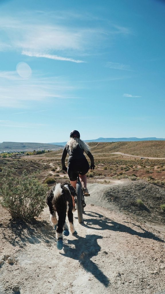
Ask any rider in the Tri-Cities where they go when they want to feel a climb in their legs, and Badger Mountain comes up first. It sits at the south edge of Richland, rises to a summit of roughly 1,579 feet, and looks down on the Columbia River, the Yakima delta, and all three cities at once. We go up it on foot in every season and on a gravel bike when the trail rules and the weather allow, and we think every city rider around here should know it well. This guide covers the trailhead, the trails, what is open to bikes, and the two hazards that matter most: heat and rattlesnakes.
Where it is and how to get there
Badger Mountain is the long ridge you see south of Interstate 182 as you drive between Richland and Kennewick. The main access is Trailhead Park, a city park off Queensgate Drive in south Richland, a few minutes from the freeway. The park has a paved lot with room for a few dozen cars, a restroom, drinking water in the warm months, and a kiosk with the current trail map. On a clear Saturday morning the lot fills before nine and cars spill onto the neighborhood streets, so we ride there when we can. From central Richland it is about six miles by bike, mostly on wide streets and the Keene Road path. From Kennewick, the Columbia Park Trail and Columbia Center Boulevard get you close, but the last mile up Queensgate is a real grade.
The mountain is protected as the Badger Mountain Centennial Preserve, looked after by a local volunteer group and the county. Dogs are welcome on leash, entry is free, and the trails open at dawn and close at dusk.
The Canyon Trail: the classic walk
The Canyon Trail is the route most people mean when they say they hiked Badger. It leaves Trailhead Park, drops briefly into a shallow draw, then climbs steadily through sagebrush and bunchgrass to the summit ridge. It is about 1.4 miles one way with around 800 feet of elevation gain, which means a steady eight to ten percent grade with a few steeper switchbacks near the top. The surface is packed dirt with loose gravel and a handful of rock steps. Most people take 35 to 50 minutes up and 25 to 35 down. The Canyon Trail is signed for foot traffic, and bikes are not allowed on it. That rule matters: the trail is narrow, the switchbacks are blind, and on a weekend it carries hundreds of walkers, runners, kids and dogs. Please respect it even when the trail looks empty.
Where the gravel bike comes in
Bikes are welcome on the longer, gentler trails of the preserve, and the kiosk map shows exactly which ones. The Skyline Trail runs along the ridge for about three miles between the summit area and the west end of the mountain, and the multi-use trails on the west and south sides connect to it, giving you a loop of roughly six to eight miles with 1,000 to 1,300 feet of climbing depending on how you link them. The surface is packed dirt and decomposed basalt, loose in places, with a few rocky sections you may choose to walk. A gravel bike with 40 mm tires handles it well; a road bike does not. Keep speeds low on the descents, yield to walkers and horses, and call out well before you pass. If you are new to the mountain, walk the Canyon Trail once so you understand how the ridge is laid out, then bring the bike another day for the Skyline and the multi-use loops.
What you see from the top
The summit ridge has a bench, a trail sign, and a view that explains why people keep coming back. To the north the Columbia bends around Richland and the treeline of Howard Amon Park. To the east the Blue Bridge and the Cable Bridge stand out over the river between Kennewick and Pasco. To the west the Yakima River comes in through its delta, and beyond it Red Mountain and the Horse Heaven Hills roll toward the horizon. On a clear winter day you can pick out Rattlesnake Mountain to the northwest and the Blue Mountains far to the southeast. Bring a windbreaker: the ridge is exposed and the wind is almost always stronger up there than in the parking lot.
Heat, rattlesnakes and goatheads
Three things can spoil a Badger Mountain outing, and all three are predictable. Heat is the first. From late June to early September, afternoon temperatures in the Tri-Cities often pass 100 F, and the mountain has no shade at all. We climb before eight in the morning in summer and carry at least a liter of water per person for the walk, more for the bike loop. Second, rattlesnakes live on the mountain and are active from spring through fall. They are not aggressive, but they warm themselves on the trail edges in the morning and in the evening. Look where you step, keep dogs on a short leash, and do not put hands or wheels into rock piles. If you meet one, stop, give it room, and let it move off. Third, puncture vine, known locally as goatheads, grows along the sunny edges of the trails and the park. The seeds flatten tubes in seconds. Run tubeless with sealant or thick tubes, and check your tires before you leave the parking lot.
Seasons, hours and a few practical notes
- Best season: March to May, when the hills are green and lupine and balsamroot bloom; and October to November, when the air is clear and cool.
- Best hours in summer: before 8 a.m., or the last hour before sunset.
- Winter: the trail is often muddy or icy on the north side; microspikes help on foot, and we leave the bike at home to protect the trail.
- Gear: water, sun protection, a windbreaker, and a spare tube or plug kit.
- Etiquette: stay on the built trails, no shortcuts across the switchbacks, and pack out what you carry in.
Badger Mountain is not a big mountain by Cascade standards, but it is ours, it is close, and it turns an ordinary weekday evening into something with a summit. Walk it first, ride it second, and go early when the heat is on.