
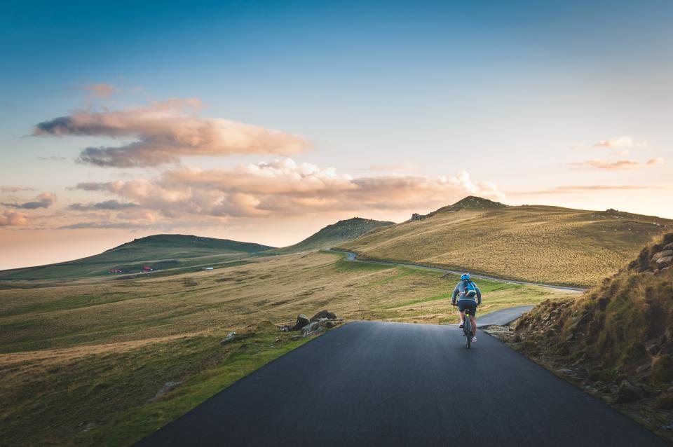
West of Richland the Yakima River valley opens out, the traffic thins, and the road starts to roll. This is the ride we do when we want real road miles with vineyards on both sides: out State Route 224 through West Richland to Benton City, a loop over the shoulder of Red Mountain, and home the same way. It is 30 to 40 miles round trip depending on how much of the mountain you add, with about 1,200 to 1,800 feet of climbing spread over dozens of small rises. On a weekday morning it is one of the quietest paved rides in the Tri-Cities.
Leaving Richland
Start anywhere in central Richland; we use the west end of the Keene Road path, where there is street parking and a small trailhead lot. Follow Keene Road west on the separated path, turn north on Bombing Range Road, then pick up Van Giesen Street, which becomes State Route 224 as it heads west through West Richland. This first stretch has a shoulder of three to six feet, a speed limit that climbs from 35 to 55 mph, and steady commuter traffic from 7 to 8:30 in the morning. After nine on a weekday it goes quiet. The road runs along the north side of the Yakima valley with the river below on your left, and the first vineyards appear within a few miles. Look for the wide pullouts before the road drops into the flats; they are the last easy places to stop before Benton City, and near the town the highway passes under Interstate 82.
Red Mountain and the AVA
Red Mountain is not much of a mountain: a bare, southwest-facing slope that rises to about 1,400 feet above sea level, a few hundred feet above the Yakima River, named for the color of the cheatgrass on it in spring. It is famous for wine. The Red Mountain American Viticultural Area, one of the smallest in Washington, covers about 4,000 acres of that slope, and nearly all of it is planted in cabernet sauvignon, merlot and syrah. For a cyclist the interest is the roads. Sunset Road climbs from SR 224 on the east side of the mountain, and Antinori Road and Demoss Road cross it higher up, giving you a network of paved lanes with gentle grades of three to six percent, almost no cars, and vineyard rows that run straight up the hill in every direction. A loop of Sunset, Antinori and Demoss adds about six miles and 500 feet of climbing to the basic out-and-back. The pavement is mostly good but chip seal in places; the descents are open and fast, with irrigation pipes and gravel at the farm entrances. We ride the mountain clockwise so the steepest grade is a climb, not a descent.
Benton City
Benton City sits in a bend of the Yakima River at the west foot of Red Mountain, a small town with a grid of quiet streets, a park by the river, a couple of stores, and a gas station. It is the natural turnaround: about 15 miles from central Richland by the direct route, 18 or so if you looped the mountain. There is a public park with restrooms and a water tap in the warm months near the river, and street parking is easy if you want to start the ride here instead and cut it in half. We do not name businesses, but you will find something to eat within a block of the main road. From here the return is the reverse of the way out, with the difference that the wind, which usually blows from the west or southwest, is now behind you.
Wind, water and traffic
The three things that shape this ride are the same three that shape every ride in the Tri-Cities. Wind first: the Yakima valley funnels the prevailing westerly straight at you on the way out. A 15 mph headwind is normal in spring and turns a two-hour ride into two and a half; a 30 mph forecast means a hard ride out and a fast, twitchy run home. Water second: there is no reliable public water between West Richland and Benton City, a stretch of about ten miles, and in summer with temperatures over 100 F you need two full bottles on the bike and a plan to refill in Benton City. Traffic third: SR 224 is a state highway with trucks, and in September and October the grape harvest puts tractors, trailers and crew vans on Sunset and Antinori Roads before dawn. Weekday mornings after nine, from April to August, are the sweet spot. Weekend afternoons bring wine tourists onto the mountain roads, and some of them are not watching for bikes.
Seasons, hazards and a few rules of thumb
Spring is the best season: the mountain turns green and then red, the vines leaf out, and mornings are cool. Fall is a close second, with the harvest color and the smell of crushed grapes, if you avoid the harvest traffic. Summer is a dawn ride only. Winter is possible on dry days, but black ice sits in the shaded dips of SR 224 well past sunrise. Goatheads line the road edge everywhere there is dirt, so stay on the pavement when you stop, and carry a tube even if you run tubeless. Rattlesnakes cross the mountain roads in the morning; give them the lane. Dogs run loose at a few of the farms; a firm voice usually stops them. And be visible: this is a road ride with 55 mph traffic on the highway sections, so a flashing rear light in daylight is not optional for us.
At a glance
- Distance: 30 miles round trip direct; 36 to 40 with the Red Mountain loop.
- Elevation: 1,200 to 1,800 feet, all in short rolling climbs.
- Surface: paved highway shoulder and quiet vineyard lanes; road bike ideal, 28 mm tires nice on the chip seal.
- Best window: weekday mornings after nine, April to June and September.
- Water: fill in West Richland, refill in Benton City; nothing between.
- Parking: street parking and small trailhead lots in west Richland; the river park in Benton City.
Red Mountain is the road ride that makes the Tri-Cities feel like wine country instead of suburbs. Go on a Tuesday morning in May, take the mountain loop, and you will have the vineyards to yourself.